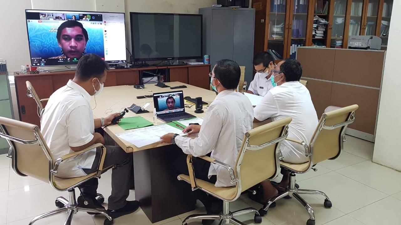
Webinar on Digitizing Spatial Planning for a Sustainable Kalimantan
"It is hoped that the digitalization of spatial planning will be useful in the process of formulating policies that are collaborative and participatory, and based on geospatial information," said the Head of the Kalimantan Province Bappeda, Timjur, Prof. Dr. Ir. H. Aswin, MM when giving a keynote speech at the virtual webinar on Spatial Digitization which was held by Mulawarman University.
Mulawarman University in collaboration with Esri Indonesia is holding this Webinar aimed at helping provide insight and understanding regarding the challenges that exist in the planning field and how GIS technology can be a solution in solving these various challenges.
This activity was attended Chancellor of Mulawarman University, East Kalimantan, CEO of Esri IndonesiaMinistry of Agrarian Affairs and Spatial Planning of the Republic of Indonesia or representing 'Arial',sans-serif; color: black; mso-ansi-language: EN-US; mso-no-proof: yes;">Head of Data and Information Analyst Subdivision Muhammad Hamsani, ST, M.Si and Staff.
On this occasion Aswin explained The implementation of spatial planning digitalization in East Kalimantan is very important, considering that East Kalimantan has enormous spatial utilization potential. East Kalimantan itself has a Regional Geospatial Information Network with the name One Data One Map which was launched by the Governor of East Kalimantan in 2014.
One Data One Map is a system that aims to create one accurate and centralized thematic geospatial database and information to support the implementation of regional development, with the target of providing geospatial data and thematic geospatial information, integrating geospatial data and geospatial information thematic, availability of sharing facilities, and optimization of the use of geospatial data and thematic geospatial information.
One Data One Map has been integrated with the regional network nodes of Kutai Kartanegara Regency and East Kutai Regency, for 2021 integration has been underway with Balikpapan City, Bontang City and Berau Regency.
Aswin further explained As an effort to create a safe, comfortable and sustainable spatial layout. geospatial is very necessary. One example of geospatial innovation carried out is the application of geospatial-based planning. "An example of the application is that every program/activity plan that will be implemented by the Regional Government must pay attention to existing provisions on spatial patterns and spatial structures, for example in planning the extensification of agricultural land it must be in accordance with its spatial designation. This is where digitalization of spatial planning is needed to facilitate the spatial-based planning process in question," he said.
(Humas BappedaKaltim/Fat)
photo : Hamsani