Technical Discussion of Ecological Areas and Riparian Areas in the National Capital Region (IKN)
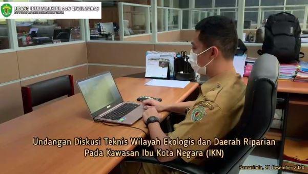
Samarinda, (21/12/2020). Head of Subdivision of Housing and Settlement Infrastructure, Alfino Rinaldi Arief, ST, M.E and staff attended a technical discussion on ecological areas and riparian areas in the National Capital Region (IKN) virtually via the Zoom meeting application.
This activity was attended by ± 85 participants consisting of elements of the Regional Government of East Kalimantan Province, the Ministry of Environment and Forestry, Research and Development Center for Natural Resources Conservation Technology, Mahakam Berau DAS and Protected Forest Management Center, Ministry of National Development Planning/Bappenas (Deputy for Maritime Affairs and Natural Resources, Deputy for Regional Development, Deputy for Facilities and Infrastructure), Ministry of ATR/BPN (Directorate General of Spatial Planning), Ministry of PUPR (BPIW, Directorate General of Natural Resources, , Directorate General of CK, PPI-IKN Task Force).
This activity aims to obtain input regarding the definition and criteria for the boundaries of riparian and mangrove areas, Obtain input regarding the delineation of riparian and mangrove areas in the KIPP IKN site planning, Obtain information and input on the function of riparian/mangrove areas for ecosystem sustainability and ecological goals in the KIPP IKN built area.
Submitted by fino IKN development needs to pay attention to conservation and protection of riparian areas which are transitional areas between water and land areas, rich in plant diversity, which provides food sources for wildlife.
IKN planning for both Urban Design and RDTR has accommodated the existence of Riparian Areas in the area IKN, especially KIPP IKN, needs to be identified in more detail before implementing development in the future. According to Fino, in order to maintain animal habitat, IKN planning needs to maintain mangrove forests and river borders plus a buffer of ± 200 M.
In the future, more detailed identification of biodiversity will be carried out, at the micro or meso scale planning stage (RTBL, Regional Design) before development is implemented so that efforts to protect animal habitat, especially in riparian areas, can be carried out appropriately at a regional or environmental scale.
(Public Relations of BappedaKaltim/Fat/Editor: Sukandar, S.Sos)