Wednesday, 24 August 2022
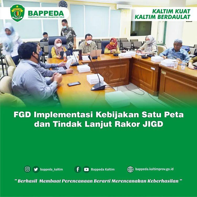
FGD Implementation of one map policy and follow -up Jigd Coordination Meeting
Bappeda Prov. East Kalimantan Implement Focus Group Discussion (FGD) Implementation of a Map Policy with Geospatial Information Agency.
-
This discussion was opened by the Secretary of Bappeda Prov. East Kalimantan Mrs. Charmarijaty and was attended by Geospatial Information Agency, Universitas Brawijaya Academics, East Kalimantan National Land Agency, Forestry Service, Energy and Mineral Resources Office, Food, Food and Horticultural Office, Public Works Office, Spatial Planning and Public Housing, Bappeda/Bappedalitbang Regency/City Mulawarman and TGUP3 Team of East Kalimantan Province.
-
The purpose of the implementation of this FGD is to obtain input, confirmation and information from the Regional Government of East Kalimantan Province along with the regencies/cities in it, related to the implementation of one map policy and the process of resolving land overlapping problems that occur in the area
-
As we know there is still a lot of thematic geospatial information (IGT) produced using non-uniform references. In some cases there are even IGs of the same type produced by several agencies.
-
This is mainly caused by several things, such as:
(a) almost all DG and IG are made long before the issuance of the IG Law,
(b) incomplete basic maps as one of the emergency rooms to be used as a reference,
(c) The lack of effective coordination and synchronization process of IG, and
(d) indecisive institutional arrangements, related to the duties and functions of implementing IG.
-
Some development activities that require IG of various types (IGD and IGT) produced by many IG organizers, starting from the activities of preparing spatial plans to handling land overlapping and licensing.
-
With all its dynamics, this one map policy is then manifested into a regulation known as Presidential Regulation No. 9 of 2016. Some things stipulated in this regulation include one map that refers to a geospatial reference, one standard, one database, and one geoportal. Specific regulations are intended to improve broad scale space planning, accelerate conflict resolution of land use, and accelerate the implementation of infrastructure and regional development programs.
#baped mutiled
#Bodies of DormasiGengeospatial
#fgDimplementasastikanSatupeta
#Networks of the Greaterformation of the area
#PPIDBABAPAALTIMTIM