Saturday, 28 November 2020
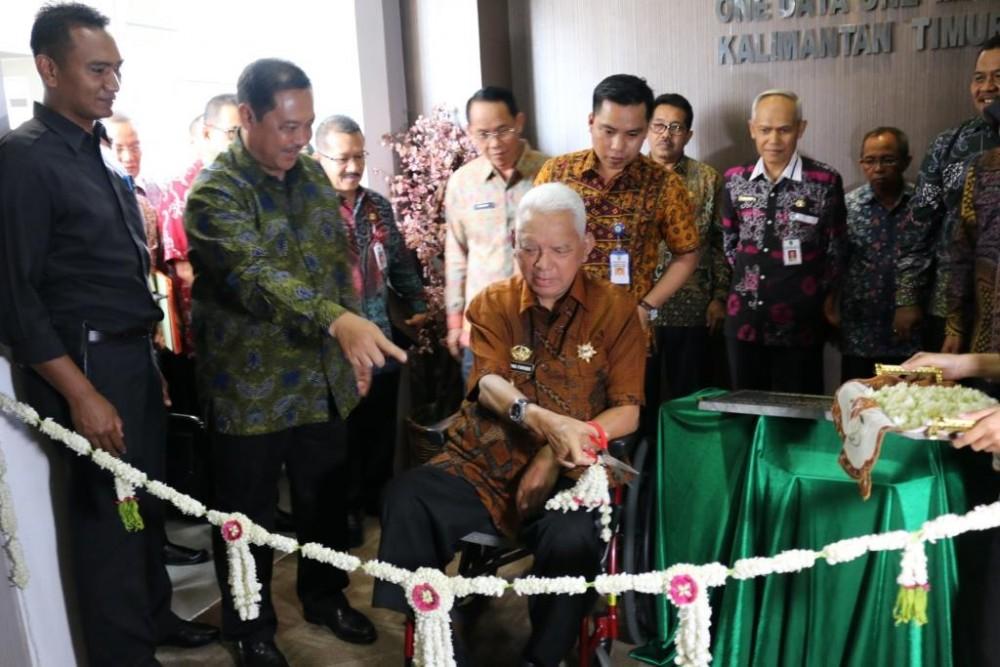
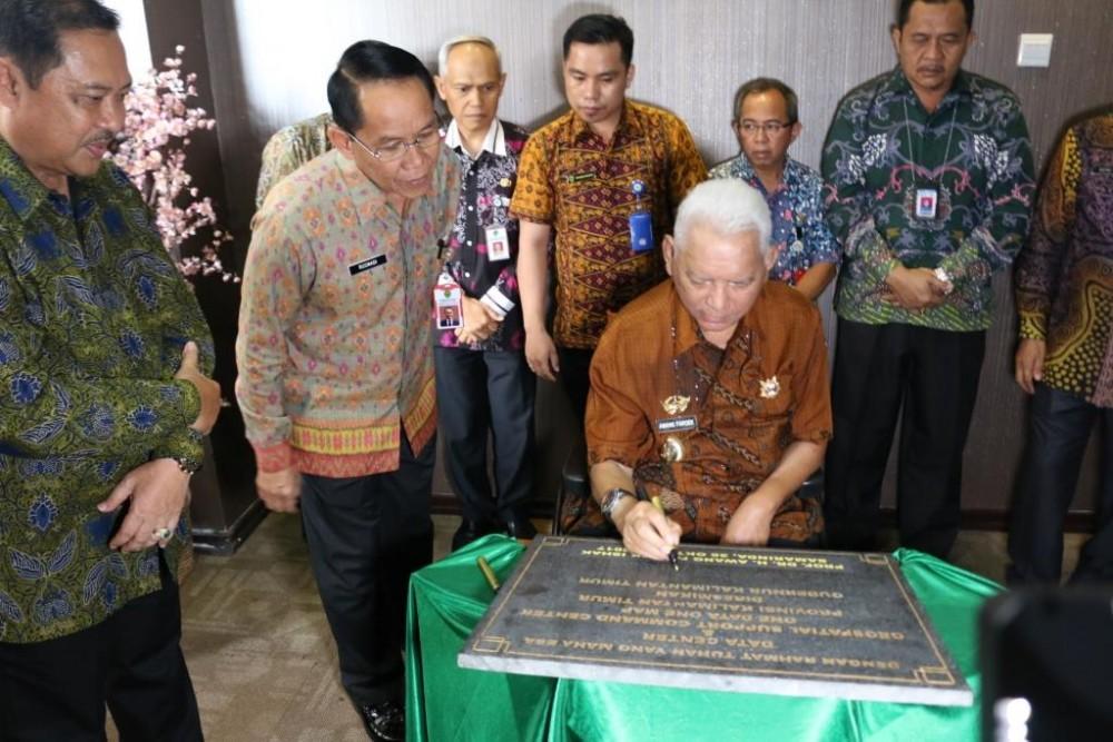
East Kalimantan Governor Inaugurates East Kalimantan GSCC Room
Samarinda, 26/10/2017. Governor of East Kalimantan, Dr.H. Awang Faroek Isahk was accompanied by the Regional Secretary of East Kalimantan Province, Dr.Ir.H. Rusmadi, MS and Head of Bappeda East Kalimantan Province, Dr.Ir.H. Zairin Zain, M.Si together with the Assistant for People's Welfare and several Heads of Regional Apparatus within the East Kalimantan Provincial Government inaugurated the East Kalimantan Geospatial Support Command Center (GSCC) Room as well as a Teleconference with the Indonesian Coordinating Minister for the Economy Mr. Darmin Nasution Phd on the 3rd floor of the East Kalimantan Bappeda, Jl. Kusuma Bangsa no. 2 Samarinda, Thursday 26/10/2017.
H. Awang Faroek Ishak said that with the inauguration of the East Kalimantan GSCC space, he hopes that its performance will be even better than before in order to solve various problems including land use, licensing for the mining, agriculture, plantation, fisheries and other sectors as well as being able to determine regional development policies that are in favor of the interests of the community and can improve the welfare of the people of East Kalimantan in particular and Indonesia in general.
The Governor added that the East Kalimantan GSCC space is a regional geospatial network space that is applied through the implementation of One Data One Map. The development of the One Data One Map system was carried out by Bappeda of East Kalimantan Province as the Management and Dissemination Unit with assistance from the Geospatial Information Agency (BIG). It was inaugurated on April 2 2014 with the One Data One Map Geoportal which can be accessed online via the portal http://onedataonemap.kaltimprov.go.id.
Legal basis of One Data One Map Kaltim
The legal basis for the formation of One Data One Map is based on the mandate of Law Number 4 of 2011 concerning Geospatial information, Government Regulation Number 9 of 2014 concerning Implementation of Law Number 4 of 2011 concerning Geospatial Information and Presidential Regulation Number 27 of 2014 concerning the National Geospatial Information Network. In order to realize the One Map Policy (KSP) in Indonesia, the East Kalimantan Provincial Government initiated the development of a Regional Geospatial Information Network (JIGD) which was implemented through the implementation of One Data One Map and strengthened with legality through Governor's Regulation Number 41 of 2016 concerning Implementation of One Data One Map which was ratified on November 11 2016. This Governor's Regulation generally regulates matters relating to the scope of the five pillars of implementing One Data One Map, cooperation, guidance and others. Apart from that, as a form of the regional government's commitment to the sustainability of this program, One Data One Map has been outlined in the 2013-2018 East Kalimantan Province RPJMD document and the 2013-2018 East Kalimantan Province Bappeda Strategic Plan with the Vision "One Reference Map for Advanced East Kalimantan 2018"
Space Utilization
The Governor further said that initially the use of One Data One Map (OD-Map) was aimed more at preventing and reducing overlapping permits. As is known, East Kalimantan is one of the regions in Indonesia that has quite high investment attractiveness, especially in the mining, plantation, forestry and food crop farming sectors, where these permits are closely related to space utilization. The use of thematic geospatial data and information (DG and IGT) which do not refer to the same Basic Geospatial Information (IGD) reference, causes a high potential risk of overlapping licensing areas, both licensing within the same sector and across sectors. (curr).