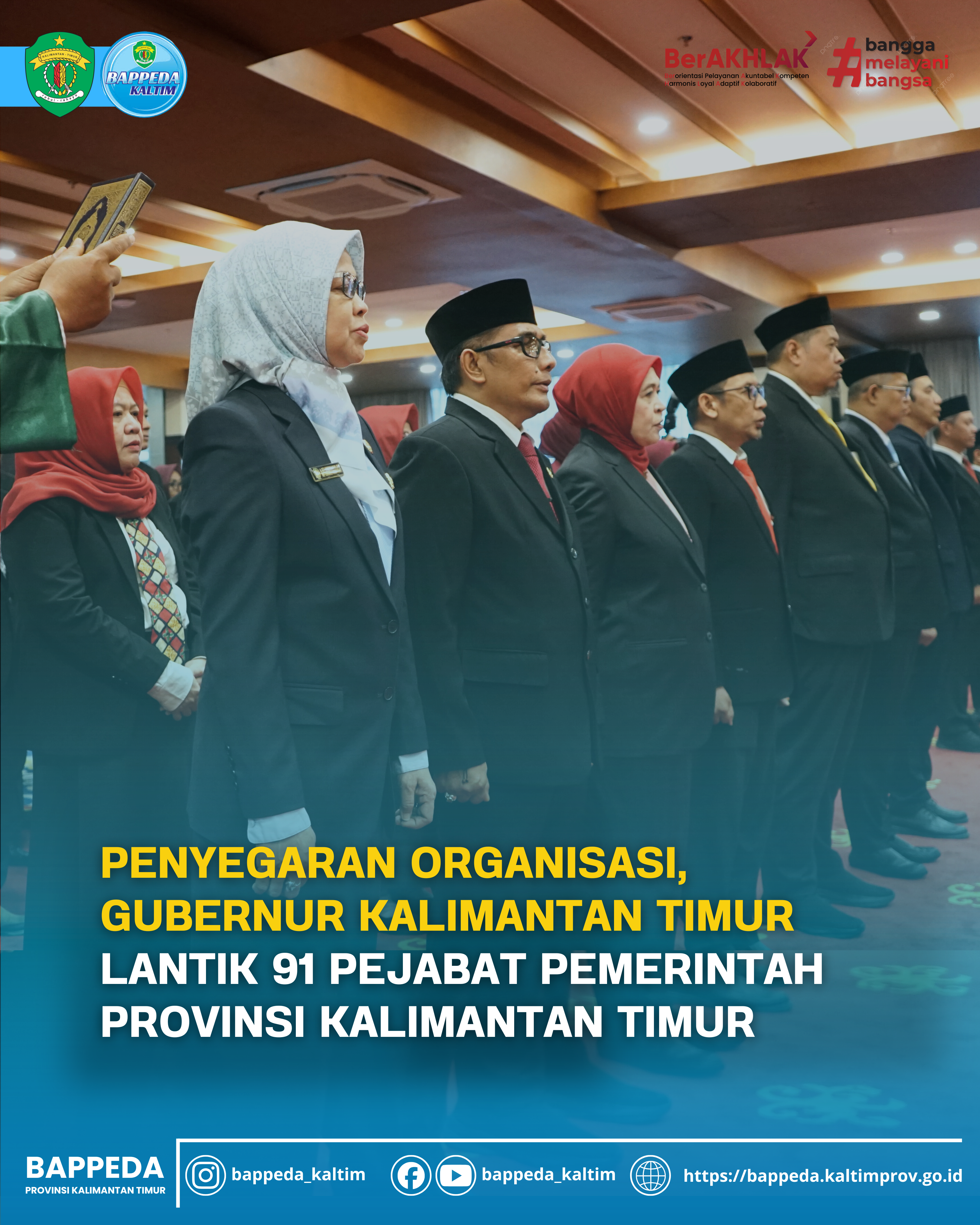
Technical Guidance for Management and Dissemination in the Context of Fostering One Indonesian Data Governance
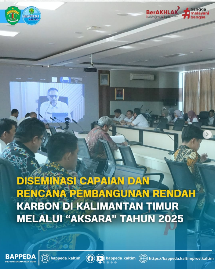
Balikpapan, (27/05/2021). In the context of managing and disseminating Indonesian One Data Governance, the Bappeda of East Kalimantan Province held Technical Guidance for Management and Dissemination in the Context of Developing One Indonesian Data Governance directly and online at the Golden Tulip Hotel.
This activity was opened by the Head of the East Kalimantan Province Bappeda, Prof. Dr. Ir. H. M. Aswin, MM and presenting resource person Drs. Oktorialdi, MA, Ph.D. as Expert Staff to the Minister of National Development Planning for Equity and Regional Affairs/Central Government Coordinator for One Indonesian Data that is Available Online, Head of Planning, Control and Evaluation of Regional Development Rina Juliati, Geospatial Information Agency and Research and Development Agency for Bontang City. Participants who participated in this event included Bappeda of East Kalimantan Province, Bappeda/Bappelitbangda of Regencies/Cities throughout East Kalimantan, Diskominfo of East Kalimantan Province, Diskominfo of Districts/Cities throughout East Kalimantan and the Central Statistics Agency of East Kalimantan Province.
- Remarks and opening of the event by the Head of Bappeda of East Kalimantan Province, Mr. Dr. Ir. H. M. Aswin, M.M said that:
- Indonesia's one data policy is needed as a basis for policy making in the era of information systems and speed of responding to change.
- It is hoped that in the future the problem of data discrepancies such as the extent of overlapping land permits in East Kalimantan Province can be resolved soon.
- Regarding this Indonesian data, the East Kalimantan Provincial Government strongly supports its implementation by continuously developing a system for providing spatial and non-spatial data in East Kalimantan Province.
- Resources/speakers who participated in this event include:
- Expert staff for Equity and Regional Affairs, Coordinator of the One Data Indonesia Secretariat at Central Level, Ministry of National Development Planning/Bappenas, Mr. Oktorialdi, Ph.D
- One Indonesian data aims to ensure that data held nationally can be more accurate, non-overlapping and uniform.
- The development of data and metadata standards is reflected in the Regulation (BPS) on statistical data standards, and No. 5 of 2020 concerning the structure and standard format of statistical metadata (activities, variables and indicators); Financial Data Service System (SLDK) Initiative to realize an integrated financial management information system (IFMIS) in realizing one financial data; BIG uses SNI ISO 19131 as a data standard guide and SNI 8843-1:2019 as a reference for geospatial metadata profiles.
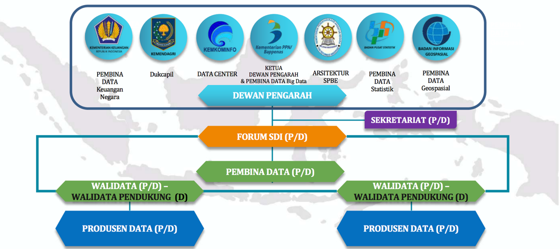
- The Indonesian data organizer is depicted in the image below
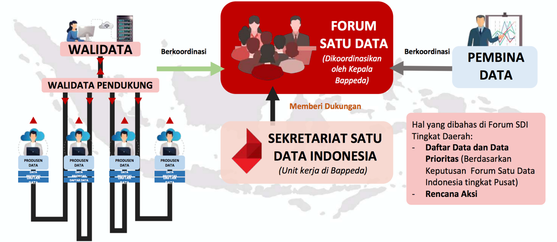
- The One Indonesian Data Forum in the regions is run according to the flow as depicted below
- To date, information on the progress of implementing Indonesia's one data principle includes the following:
- Related to data standards and meta data
- Regarding statistical data, BPS regulation no. 4 of 2020 concerning technical guidelines for data standards; BPS regulation no. 5 of 2020 technical guidelines for metadata; work plan for implementing data and metadata standards 2021.
- Regarding geospatial data, published geospatial data and metadata standards are contained in the Indonesian geospatial element catalog (KUGI) with reference to SNI 8843-1:2019 and ISO 19131; work plan for implementing data and metadata standards 2021.
- Regarding financial data, the state prepares guidelines for financial data and metadata standards attached to financial application operating guidelines with reference to IFMIS; work plan for implementing data and metadata standards 2021.
- Related to reference code and parent data
- BPS has carried out bridging/relationships between the administrative area codes according to the Ministry of Home Affairs, BPS and PT.POS. The SDI Secretariat is preparing an SDI forum to agree on an integrated administrative area reference code as a reference for K/L/D.
- The One Data Indonesia Forum (15 February 2021) agreed that NIK-based dukcapil data would be used as the sole master data for the Indonesian population.
- One Data Indonesia Forum (10 May 2021) discussed reference codes for health service facilities in order to accelerate handling of the Covid 19 pandemic.
- Regarding interoperability
- The development of the Indonesian one data portal is in the clearance process by BSSN and KemenPAN-RB. The Beta version of the data.go.id portal is already operational and integrated with 51 K/L/D portals containing 94,690 datasets.
- The Ministry of Communication and Information regarding data interoperability services is currently being reviewed by Kominfo.
- Regarding data identification activities in Ministries/Agencies, currently there are 74 K/Ls attending data identification activities which will be held on 5-16 April 2021, and only around 20 K/Ls have collected data identification forms which can later be processed into a data list.
- In relation to the role of data for more optimal regional development planning. The indicators used in each program and activity specified in the Regional RKP are synchronized with the validity and availability of regional data. Good data quality has an impact on good planning of programs, activities and indicators.
- Head of Regional Development Planning and Evaluation Control of Bappeda East Kalimantan Province : Mrs. Rina Juliati, S.Si, M.Si
- Related to the development of one database and geospatial information, the East Kalimantan Provincial Government has developed One Data One Map on April 2 2014.
- 5 pillars in the development of one data one map, namely policy with gubernatorial regulation 41 of 2016; institutions under the coordination of the data and information analysis sub-sector; human Resources; data standardization; infrastructure and technology.
- Governor Regulation No. 27 of 2017 concerning regional geospatial information networks is a follow-up to PP no. 27 of 2014.
- The data production working group consists of 25 OPDs
- As of 2020, 178 thematic geospatial information has been published by the East Kalimantan Provincial Government which has been approved/validated through the data forum.
- The target by 2023 is to reach 200 thematic geospatial information that has gone through the standardization process of Perka BIG No.12 of 2013.
- Until now, only 5 (five) regencies/cities have JIGD, namely Kukar, Kutim, Balikpapan, Bontang, Berau. However, of the five regions, only Kukar and Kutim have been integrated with the Province.
- Several regions such as Samarinda, Paser, PPU, Kubar and Mahulu do not yet have JIGD.
- The plan to develop the JIGD one data one map node related to policy aspects will include the addition of applicable SOPs and Perka; related to institutions, there will be an expansion of the scope of membership of the od-map working group; related to infrastructure & technology, sharing functions (online geodatabase) will be increased; related to HR, training will be carried out in the field of GIS according to KUGI, SRGI and Metadata; related to data standardization, adjustments will be made to the Catalog of Indonesian Geography Elements (KUGI), SRGI and 200 IGT publications.
- Geospatial Information Agency (BIG): Mr. Syamsul Hadi
- The legal basis for implementing GI is Law no. 4 of 2011 regarding geospatial information, Presidential Regulation no. 27 of 2014 regarding the national geospatial information network, Presidential Regulation no. 23 of 2021 article 8 for the one map policy, Presidential Regulation no. 39 of 2019, BIG Regulation no. 4 of 2020 article 46/47 concerning the main duties and functions of the IG management and dissemination center.
- Steps to fulfill the implementation of geospatial information according to the principle of one Indonesian data, namely preparing data standards in the form of data product specifications.
- Data standards are technical requirements or something that is standardized. SNI ISO 19131.
- The scope of geospatial data management (PPN regulation 16 of 2020) is data architecture, master data and reference data.
- Implementation of the principle of one Indonesian data, namely data product specifications.
- The way to compile metadata is that data producers produce data according to standards and fill data quality information into metadata; walidata completes metadata with information on quality assurance results and disseminates data and metadata (catalogue service for web).
- Data quality consists of quality control, quality evaluation and quality assurance.
- At the evaluation stage, quality consists of logical consistency, completeness, positional accuracy, thematic accuracy, temporal quality, usability elements.
- Bappeda Bontang City : Mr. Muji Esti Wahyudi, ST, M.Si
- 90% of Government activities have spatial elements, and 65% of Government activities use spatial elements as the main identification.
- Geospatial data and information are not easy to develop because most of the data available is limited to tabular data and does not have coordinate points.
- All development activities must be planned based on spatial and non-spatial data as well as other information that is accurate and accountable as mandated in Law no. 25 of 2004 concerning the National Development Planning System.
- From 2013 to 2021 the City of Bontang has consistently carried out a number of activities in the context of developing geospatial information (the Bontang City geoportal) based on 5 (five) aspects of policy, data, institutions, human resources and technology. The Bontang City Geoportal can be accessed at petakita.bontangkota.go.id.
(Humas BappedaKaltim/fat)